Eric a blogger from LA kind of kicked off this post. I like to cruise other blogs, and a link to Cartifact was incredible--homeless maps and more. I love maps, especially good maps. This all seems a little disjointed but it is interesting seeing how the rest of the world lives. Both Eric and Cartifact have some interesting finds.
Of course interesting and relevant are two different things. Oklahoma. Google Earth is the free download and you can get a pretty good idea of the state with this.
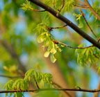
I like the department of wildlifes site for Oklahoma's mammals, birds, reptiles and amphibion information.
The USDA Forest service has some maps (roadless maps). Too bad they don't have a more extensive collection. Becareful, this site can bog your machine down.
Today Water watch is showing normal precipitation. Water watch is a map of real-time streamflow compared to historical streamflow for the day of the year for Oklahoma. Also at the USGS water site is
Map of flood and high flow condition
Ground water watch
Water quality
Drought watch
Seismicity of Oklahoma and other quaky info from USGS
Terraserver has a great aerial and topo map site
The USGS national map viewer
Oklahoma's Aquifer info and maps
NOAA's Weather map
NOAA's serious data tables on average everything to do with climate
Make a map with National Atlas.gov This is a great source.
OTC hiway bypass info--I've not quite figured this map out, but it might come in handy for something
There is an endless supply of maps on the web. I'm signing off for the night. I'm sure I'll run across more to add at a later date.
I am a landscape architecture student at the University of Oklahoma. This is a place where I can explore links and relationships of landscape and Oklahoma.
Jord Wilson

DAYS TILL GRADUATION
Graduate Student of Master of Landscape Architecture;
Bachelor of Science in Environmental Design;
Minor in Interdisciplinary Principles of the Environment;
College of Architecture;
University of Oklahoma
wanderings
I was born in Oakland California. I grew up in North Central Washington, in the eastern foothills of the Cascades and on the Columbia River. I graduated from a school of 250 students K-12. I didn't attend college until after I was 30, so I brought to school my experience: garden designer, carpenter, concrete worker, florist, greenhouse manager, perennial expert, shrub and tree salesman, bus driver, truck driver, apartment manager and maintenance man. Frequently I worked 3+ jobs a day during my go-get-'em-like-your-killin' -snakes years. So I was well prepared for the vigor's of the University and the initiation rituals of the Architecture department. I graduated from the College of Architecture with a Bachelor of Science in Environmental Design and a minor in Interdisciplinary Perspectives on the Environment. College has allowed me to bundle my many paths into a single and wide corridor. I started my Master of Landscape Architecture program at the University of Oklahoma in the fall of 2006.
bearings
Knowing where I've been is the easy part. Knowing where I come from and where I am going is the challenge. I moved into a little rent house out in the country about 15 miles south of Norman Oklahoma. During my first winter in Oklahoma, I dabbled in some genealogy. I found two great-grandfathers and their families buried within a few miles of my new home. It was not just serendipity that my internal way-finder connected and centered me in the place of my forefathers. I have a deep connection with this place.
compass
The spirit of place.
Present and past human connections influence our lives. Community, family and place are part of our soul. Regional identity is both cultural and physical. The spirit of place is what nourishes our beginings and tethers our world view. It is also that soul and bond that embraces our community.
Technology has allowed us to disregard the environmental aspects of place. The media wants us to believe we are a global society and that our world is getting smaller. Our world gets smaller when we exchange our spirit of place for anothers.
The spirit of place must be unearthed again to regain the comfort of belonging.
BLOG ARCHIVE
-
▼
2007
(137)
-
▼
January
(17)
- Ouchita National Forest
- Touring OK
- The Cutting Edge
- Adaptive Reuse
- Design at its finest
- Green Industry
- Wichita Mnts
- Craigieburn Bypass
- Home town photos
- Cartograhpy
- More Ice storm pictures
- Stream Team Conference
- Christmas break work
- Ice storm
- "Oh, what a beautiful mornin'..."
- African American plaza--Capital Complex
- Make a walk your New Years resolution
-
▼
January
(17)
OKLAHOMA
- adobe kuler
- ak river plan
- criterion group
- deq--ok's epa
- myriad gardens
- nature conservancy
- noble foundation
- ok "putting down roots"
- ok biosurvey
- ok climatological survey
- ok greenhouse growers
- ok survey of woodies
- ok tourism
- ok wetlands reference
- okc--will rogers park
- okplanttrees
- ouachita national forest
- pontotoc ridge preserve
- wichita mnts refuge
- wildlife conservation books
PROFESSIONAL
ECOREGIONS
RIPARIAN
SOILS
PHOTOGRAPHY
PLACES
GIS
MY TOWN GOV.
SUNDRY
LEARNING FROM OTHER PARKS
book wish list
blogline
ENVIRONMENT
URBAN
LANDSCAPE ARCHITECTURE
RURAL
TOOLS
PLANTS